GT Rider Posted September 20, 2020 Report Share Posted September 20, 2020 Quebec granted on September 8 a sum of approximately $ 390,000 to the City of Rivière-du-Loup to extend an off-road vehicle trail from Beaubien Street to Cartier Boulevard, in order to allow snowmobile enthusiasts and mountain biking to have access to the various services offered there. A project that dated from the early 2000s and had not yet come to fruition. “This is an old project that will allow snowmobilers and ATV riders to fill up with gasoline, and to take advantage of accommodation and catering in this sector. This is a plus for our tourism industry. We've been talking about it for 20 years, ”explained the member for Rivière-du-Loup-Témiscouata, Denis Tardif. The latter described his announcement as "excellent news" for the economy of Rivière-du-Loup. The Trans-Québec 85 trail, which goes to New Brunswick, will thus be extended from route 291 to Boulevard Cartier, in Rivière-du-Loup. “Due to urban development in Rivière-du-Loup, off-road vehicle enthusiasts have gradually lost their access. It's a problem that had to be solved […] Touristically, it pays a lot, we want people to be able to go to the North Shore, to have packages, to come back after spending a day on the other side. of the river ”, illustrates the mayoress of Rivière-du-Loup, Sylvie Vignet. The project is valued at just over half a million dollars, of which $ 390,000 is funded by Quebec and $ 125,000 comes from the City of Rivière-du-Loup. The rest of the funding was provided by various partners. “What helped us unlock was that we used the old railroad to trade land with different owners. That's a lot of people with whom to find agreements. The clubs work in partnership to move in the same direction, ”explains Ms. Vignet. Access to the trail, from the Manne Rouge grounds, will therefore be secure for the next few years. A new tool that will improve the tourist attractiveness of Rivière-du-Loup for ATV and snowmobile enthusiasts who can now stop there to fill their gas tanks or even spend a few nights there, summer or winter. PLAYHARD, MrGutz, Pipemaster and 5 others 4 4 Quote Link to comment Share on other sites More sharing options...
PLAYHARD Posted September 22, 2020 Report Share Posted September 22, 2020 Never had a problem accessing gas & all @ Universal! nyskidooerinnewhampshire and GT Rider 2 Quote Link to comment Share on other sites More sharing options...
dooright Posted September 22, 2020 Report Share Posted September 22, 2020 Maybe the trail will go to that Monroe place ? 😁 Quote Link to comment Share on other sites More sharing options...
GT Rider Posted September 22, 2020 Author Report Share Posted September 22, 2020 The Doo dealer is there. Not an issue for some!😀 Quote Link to comment Share on other sites More sharing options...
EastMark Posted September 22, 2020 Report Share Posted September 22, 2020 Cant picture where that comes off or goes...or why. Quote Link to comment Share on other sites More sharing options...
GT Rider Posted September 22, 2020 Author Report Share Posted September 22, 2020 PLAYHARD and dooright 2 Quote Link to comment Share on other sites More sharing options...
NSHM Posted September 23, 2020 Report Share Posted September 23, 2020 Nice to gain trail instead of losing trail! PLAYHARD 1 Quote Link to comment Share on other sites More sharing options...
Blueblood Posted September 23, 2020 Report Share Posted September 23, 2020 The trail went there last year. I have stayed at the comfort inn before. Not sure why they are saying its new? Quote Link to comment Share on other sites More sharing options...
MrGutz Posted September 23, 2020 Report Share Posted September 23, 2020 4 hours ago, Blueblood said: The trail went there last year. I have stayed at the comfort inn before. Not sure why they are saying its new? "Bold New Signage" BNS this model year? Either way sounds good!! GutZ PLAYHARD 1 Quote Link to comment Share on other sites More sharing options...
Blueblood Posted September 23, 2020 Report Share Posted September 23, 2020 Maybe some sections of that trail are going to be different? Quote Link to comment Share on other sites More sharing options...
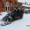
EastMark Posted September 23, 2020 Report Share Posted September 23, 2020 I just hope there are riders from the US on them this season.... 🙂 ....thanks for the pictures mikerider, PLAYHARD and GT Rider 2 1 Quote Link to comment Share on other sites More sharing options...
mikerider Posted September 24, 2020 Report Share Posted September 24, 2020 The mayor of RDL must have been into the vin rouge pretty mighty to approve $390,000 for that project!!! Blueblood, dooright, GT Rider and 1 other 1 3 Quote Link to comment Share on other sites More sharing options...
EastMark Posted September 24, 2020 Report Share Posted September 24, 2020 (edited) I think the manager of the Comfort Inn furnished the vino Mike. For $390000 they could have made that (real) Mayor Mike’s underpass/cut thru pretty damn nice. Edited September 24, 2020 by EastMark GT Rider, PLAYHARD and mikerider 2 1 Quote Link to comment Share on other sites More sharing options...
GT Rider Posted September 25, 2020 Author Report Share Posted September 25, 2020 The map I posted does not show all the residential growth. It appears the trails go through where homes are located. Google earth and Garmin maps are not working together any longer so its difficult to show the exact path. As far as the new trail I'm not sure how it will be routed. For me I might have to make a trip to the Doo dealer or St Hubert. We stay on the other side of town with Mike. Mike showed us some very nice places to eat. Its a 6 min drive to the municipal parking lot. Looking forward to a return. mikerider and PLAYHARD 1 1 Quote Link to comment Share on other sites More sharing options...
Blueblood Posted September 25, 2020 Report Share Posted September 25, 2020 As I remember the trail it ran down the side of the off/on ramp and looped to the right on the way out. Discovered last year they also shut down a lane going over 20 to get to the quality inn. Quote Link to comment Share on other sites More sharing options...
Recommended Posts
Join the conversation
You can post now and register later. If you have an account, sign in now to post with your account.