
favarcat
-
Posts
85 -
Joined
-
Last visited
Content Type
Profiles
Forums
Calendar
Posts posted by favarcat
-
-
Thanks for the welcome guys and your feed back. 600IQ I am still interested in riding but I called le cabanon and they are booked Saturday night so I will most likely stay at le glacier and meet up with you first thing Sunday morning so let me know what time you are planning on heading out
I had 4 rooms booked at le Cabanon and 2 guys backed out. I just cancelled a room for Fri. and Sat. night. If you give them a call, a room should be open.
-
They do have to be set-up properly for handling. Snowtrackers on the skis and it handles great with light steering. Best mod I did to the sled. Mono suspension on Apex/Vectors is a plush ride. Not made to bash 2-3 ft moguls if that is what you want. They go forever on belts. On my 3rd belt with almost 22,000 miles on it. Change them for maintenance not because they blow.
-
Hey Jack, Myself and Gary also want to head up somewhere Sunday. Watching to see what happens.
-
Just retired myself !!! 34 years in jail. Feels great to be done and back riding again. 3 years I haven't rode in Quebec. I've been up the last 2 week-ends and looking forward to next week.
Let me know how things look Thursday. If you want to ride next week with us you're welcome to. Bruce.
-
Looks great Mike, Myself and GW (Gary), are headed up somewhere Sunday for 4 days of riding. We were going to try the area you're at now. Have to see how they make out.
Gary has ridden there, but I never have. Nice to go to a different area. Bruce.
-
Does the trail to Kanawata still go through Chateauvert from repo?
-
You can shoot across the lake and save 20K. Mario and Celine are sweethearts and really do a nice job, have stayed there a least 10 times.
Do you have a gps track for the lake?
-
favarcat where did you get the NY map, I'm looking for one?
Here is a link for the 2012 NY map. I do not have the 2013, but don't imagine it changed much.
-
I posted this above in the GPS sticky thread.
Here is a routable 2011 Quebec map.
Inside folder is application and read me text.
-
Here is a routable 2011 Quebec map.
Inside folder is application and read me text.
-
Here is a very good free topo map of Canada.
http://www.ibycus.com/ibycustopo/
http://thepiratebay.org/torrent/5629539/Ibycus_Canada_Topo_Maps_3.2
-
What is trail R to Kanawata? Is it the old trail up to Chateauvert or a trail direct from Repo to Kanawata?
-
Hey Ray, I've stayed at Balbuzzard, Haltapache, and Relais 22. Balbuzzard is a very nice place. I heard Haltapache is not open any more. Relais 22 is another good place with a restaurant there. Whatever fits into your mileage the best.
You could also run down to Kanawata for the night. You would have to back track the next day, but it's one of the best trails in Quebec and another very nice place with food there. It's about 35 miles down from the Casey intersection on 83. Have a good trip.
-
Both guys with me last year had the relay issues the year before. I'm not bashing just stating the facts as they happened. I don't hate Yamaha either, so please don't put those words in my mouth. I just don't think they or any sled for that matter is the end all be all. You said it yourself that you've been on Yamahas for like 30 years now or something so how do you really know you're riding the best if you don't ever get on anything else???? I now own 3 Polaris and 1 Ski Doo, I would have a phazer for my kid if i could run across one for a good buy. We are going up the end of Feb and will be riding in the St Jean/Valin area. There will be 1 red Polaris Switchback, 1 Blue Apex, and 1 very sweet all black 1200 GSX(that guy came off the Apex). Still has the sled though.
Yamaha really has you where they want you!! You need to get those blinders off and look around just to make sure your not missing anything. Screen name and all the gear will be hard to change though.

See you in Canada, Eh?
I had a relay freeze up at the HI 2 years ago. The Doo sdi's did the same thing. We carry a spare $5 relay in our pocket. If it doesn't start on a very cold morning, we put the warm relay in. Takes about 1 minute and we are finished before the 2-stroke guys are filling up with oil. But I will not spend $14,000 on a new snowmobile no matter what make. I will be keeping mine another 2 years at least. Depreciation is good for the buyer when you're looking for a low mileage 2011 or 2012.
-
Download the installer. I have it uploaded here.
http://www.mediafire.com/?myntkohjqq4
The Read Me for it is below:
Quebec Sled Trails - Color Coded - unofficial trail map for Garmin GPS units
It is recommended you have the latest software updates for your GPS
and Mapsource...both can be downloaded from Garmin's website for FREE.
This map installs into Mapsource where you can select it for upload
to your Garmin color GPSr. The map has a transparent background
so your units base map or any detailed maps you upload along with
the trail map will show through.
To Install Map:
double click the filename QuebecSledTrailsColorCoded.exe
this will install the trail map into Mapsource where you can select it
for upload to your Garmin GPSr.
To Use Trail Map:
start Mapsource...
from the dropdown product list select Quebec Sled Trails - Color Coded
the trail map will appear in right side panel NOTE: you will only see
the trails in Mapsource (no background maps)...this normal...once you
upload the trail maps to your GPSr they will combine with your basemap
or Topo maps.
click the Map Tool icon...use the Map Tool to click the trail map
the map is now ready to upload to your GPSr
* if you have other Garmin detailed maps such as US Topo, City Select etc
* you want to upload along with the trail map, select them now....go to
* dropdown product list and select the other map(s) you want to install
* use the Map Tool to select the map tiles you want
when you have all the maps you want click the Send to Device icon
when your GPSr is recognized click Send
the maps will now be uploaded to your GPSr
Note: most Garmin GPSr units ship with the Map Detail setting set to Normal
For optimal use of your maps read your GPSr manual section on Map Set Up
and change this setting to Most
The Quebec Sled Trails - Color Coded map can be removed from Mapsource by
selecting it in Add or Remove Programs in the Control Panel.
-
Yes it is, but has not been updated in a couple years. Still very good though.
-
I have them uploaded and you can get them in this post.
-
This is a free legal Canada topo map that is better than Garmins.
http://www.ibycus.com/ibycustopo/
You can download it below. It's a big download 3.8 gb.
canada ibycus v2.1 topo
4 parts for mapsource
run setup--its in mapsource unlocked
http://www.megaupload.com/?d=E2WE00JK
http://www.megaupload.com/?d=PVQHNWXR
http://www.megaupload.com/?d=Z7ZNT50P
http://www.megaupload.com/?d=4DXFA4QE
And if you need Mapsource, do this.
Download the Training Center:
http://www8.garmin.com/support/download_details.jsp?id=835
Install it
Then download the MapSource update:
http://www8.garmin.com/support/download_details.jsp?id=209
Install it.
-
how do the guys with the nuvi 550's get around the fact that the 550 does not come with a mapsorce disk?
Download the Training Center:
http://www8.garmin.com/support/download_details.jsp?id=835
Install it
Then download the MapSource update:
http://www8.garmin.com/support/download_details.jsp?id=209
Install it.
You now have MapSource, enjoy!
-
You're very welcome.
-
St.Andre area?
-
I just uploaded the map for download.
http://www.mediafire.com/?myntkohjqq4
Also some Quebec waypoints.
-
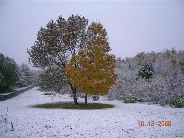
From our front porch Tuesday morning.
-
How many did Scott have?
Scott had the same Quebec miles, 3700.
130141 + 3700 = 133841

Secure Parking for rigs in Gaspesie
in General Discussion
Posted · Edited by favarcat
GPS would be 49.217954,-65.888081