
Je me souviens
-
Posts
729 -
Joined
-
Last visited
-
Days Won
67
Content Type
Profiles
Forums
Events
Everything posted by Je me souviens
-
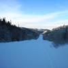
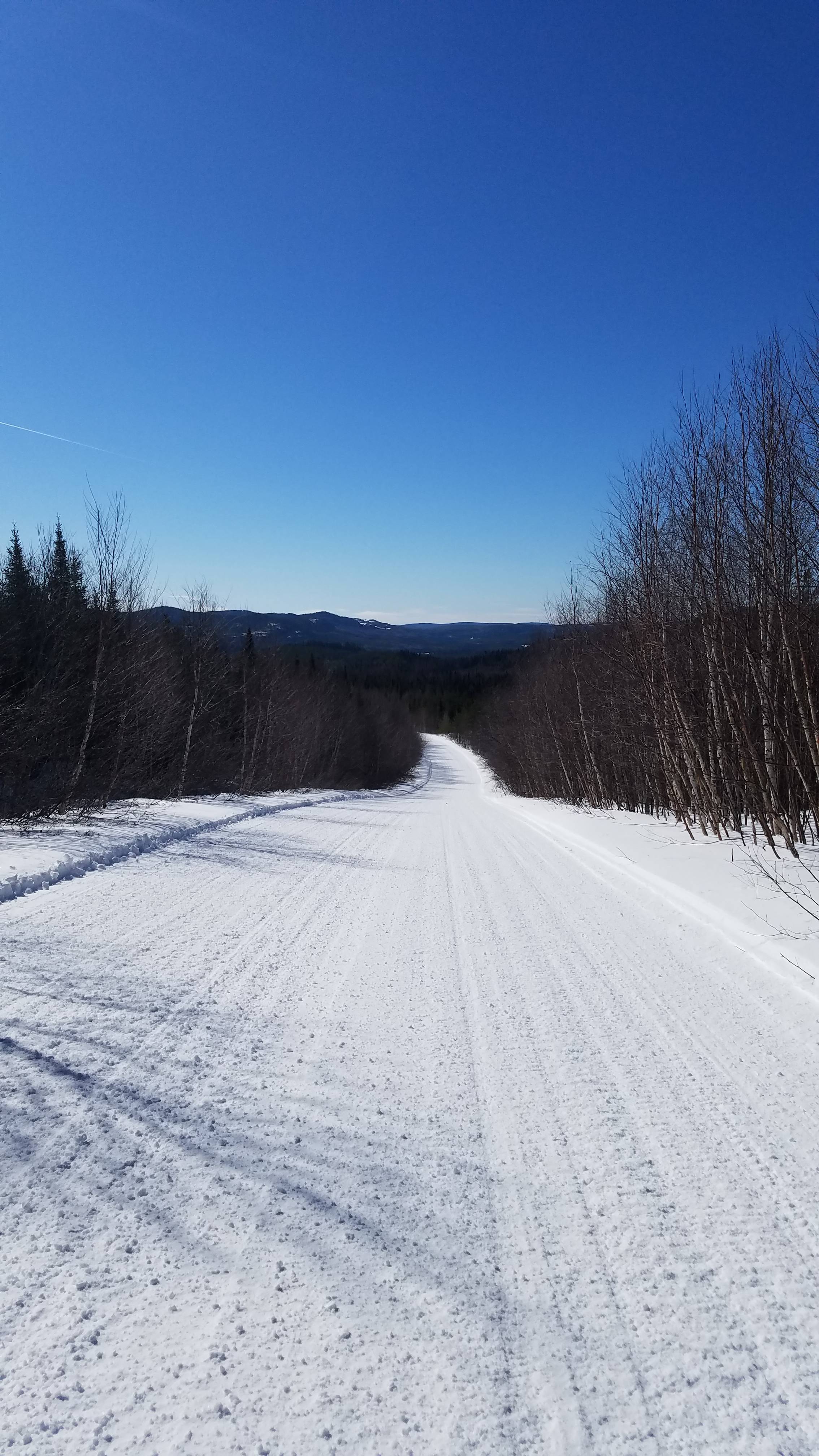
A Few Random Pictures From This Season
Je me souviens replied to Je me souviens's topic in General Discussion
A couple more... -
Here's a few random pictures from this season. I like to share what I see, join in if you feel like sharing yours.
-
Shane, if you are looking to minimize miles hauling, I would consider straight up 87/15 to the park. There is enough snow, some ice but that is to be expected after a 50 degree Friday. The rain went all the way up to Chibougamau, so I don't think there is any avoiding it. My usual riding partner just got back from the HI said it was good from north of the river in sweet baby St-Raymond to the HI flat and hard packed. That's my input. Hope it helps.
-
Last week end we left Mont Laurier in the storm 3.5 hrs home turned into 7hrs home.
-
Well I brought my girlfriend for her first Quebedor experience. We stayed at the Chalets St-Guillome nice place, fair price, the bonus is your own hot tub, a big plus when you have your woman with you. We rode 160 miles day one, headed towards La Macaza for lunch, then back to the hot tub. Day two 130 miles, we headed through the park up to Black mountain so she could feed the birds, a new experience for her, met some people from California at the summit. We had lunch at Coin Lavigne, met up with our friends from Brewster and Florida, that we met the day before, he had some interesting pics of a guy that lost control of his sled a few minutes earlier. Spun out, hit a tree and the sled blew up. Luckily the guy jumped off and only hurt his leg a little bit. I looked for the crash site on my way through, the only thing you could see is a small part of the snow bank missing and some scorched trees. Day three, 90 mile jaunt over to Lac Odelein camp site in the Reserve Faunique Rouge-Matawin, to my girlfriend's delight I found a bathroom in he woods for her, it was actually really nice. Then back to the chalet to pack up for the ride down 15 Sud with the idiot's on the highway. Never fails with the traffic right at St-Sauveur. I think they should re-name it St-Sauvage. All told it was a great trip for the two of us. Here are some pics. The burnt sled can be found on 63 between La Macaza and SMDS, it is not the wreckage I wrote about near Coin Lavigne.
-
Montagne Noire or Black Mountain is another place you would probably like to see, bring some granola or seeds to feed the birds, they will eat right out of your hand. It is marked on the map of lanaudiere where it is, really close to the village of Saint-Donat.
-
Merry Xmas to all QR forum members, I will also join the snow prayers. Hope to see some of you on the trails. I have my QR sticker on my sled, in hopes that someone sees it and says hi.
-
AdmdQ, farmer blockade update
Je me souviens replied to Greg du Vermont's topic in General Discussion
I know I am not Greg, but here is the link to join http://www.admdq.org/abonnement/abonnement.html The left one is by phone on your credit card 1-4pm Monday through Friday The middle one is by pay pal, and will automatically renew itself The right one is the link to print the form to pay by mail, send to address listed All links are $20/year 10% discount offered at many lodging places, including the Roquemont. Sweet -
AdmdQ, farmer blockade update
Je me souviens replied to Greg du Vermont's topic in General Discussion
If can put my 2 cents in here I would say that we must stand together in order to have a solitary voice of reason heard. If we all stand on the side lines and complain, no consistent unified voice will be heard. I see the importance of becoming a member of the ADMDQ more than ever. This is our loudest, most organized outlet for our concerns when the decision makers get together to sit at the round table and figure out what the ultimate answers are. I may speak for myself, but I feel all the members here on QR should become members of the ADMDQ. After all, we owe it to ourselves to become involved in some sort of collaborative effort in order to protect out dearly beloved sport. There are many different special interest groups that would love to see the sport take a back seat in Quebec. We can no longer take for granted that when the snow flies, the signs will be up, and the system will be there to take us on these great rides through the most remote areas we enjoy so much. I remember last year when Greg wanted input from us, in order to give the American snowmobiler's perspective on why we head to Quebec, when there are trails in our own back yards. The most common response was that we enjoyed the interconnectivity of the trail system. It enabled us to go on rides that for example start from just north of Montreal, and head all the way to Chibougamau, and back without retracing your footsteps. The parks are becoming increasingly off limits, the remaining trails are having time limits imposed, and most discouraging of all the farmers holding us hostage for their needs. We must join together and get out voice heard, and again the most respected, and most organized voice seems to be the ADMDQ, so lets get on their website and join the cause. If you need help with translating what the site says feel free to PM me and I will get the English version to you ASAP. We can't afford to wait for special interest groups to become unified and drown our voice out. Lets get active and support the ADMDQ! -
I have called the relais Rouge-Matawin, it will be closed this year. I spoke with one of the ladies that is a cook there, Sylvain was out on the property as it is hunting season...I will be calling Sylvain back tomorrow to find out what exactly is going on, but from what Diane said they will be closed due to insufficient revenue. I find this hard to believe as most of us know the place is packed all week-end long. They are presently cutting a new trail that will skirt the park. This season will apparently be the last time you will be able to enjoy the scenery in the Tremblant park. If you have yet to see this area I highly suggest it. Start in St-Donat, cross the lake, go up Montagne Noire for a picture, then head through the park towards St-Michel, however take the left towards la Macaza, beautiful place with little traffic. I am extremely disconcerted at the fact we will be losing this park, if this trend continues imagine where it will end. Leaving St-Ray to head up to the HI without passing throught the Jaques-Cartier park, would be much less enjoyable. Or heading east from our old friend Bernard's place, rest his soul, and not being permitted in the Mastigouche park, makes the ride to the hole known as the Cabanon a little less scenic. I will be researching a name to send our thoughts about the Tremblant park relais closure. The persons name is Martin Soucy, still need a confirmed address though. Please let me know if you have information about this matter. George
-
Love it, hope to grow old enough to have those symptoms, in decent health. Not sure if you guys read this one, but thought you guys should get a chance to enjoy it. Said: Results of a recent survey found that more money has been invested in erectile disfunction, and breast implants research than alzheimer's disease. Great, all I have to look forward to is a society full of elderly people walking around with hard-ons and perky tits, but can't remember what to do with them..... For Groomer. La joke disait: Recament on a trouve que aux Etats-Unis on depense plus d'argent sur la recherche de la disfonction du penis, et les implantations des seins que sure l'alzheimers. Donc tout ce que j'ai a m'attendre quands je suis age, ces un monde remplis de personnes bande et de seins qui sons bien remplis sauf personnes peut se souvenir quoi faire avec.
-
I am not sure if I was reading it correctly, going to call Sylvain to find out for sure, but the SEPAQ website says that the "cafeteria", in the park will be closed permanently. I am hoping that they meant somewhere else. Here is what the site said. "The number 63 Trans-Québec trail links the Laurentides and Lanaudière regions. It crosses Réserve faunique Rouge-Matawin for a distance of 80 km. Please note that the gas station and restaurant that were located in the Saint-Michel sector have been CLOSED permanently." Look-up snowmobiling in the Reserve Faunique Rouge Matawin site. I hope I am not reading it right. The link:http://www.sepaq.com/rf/rom/
-
I have a Garmin 60 CSX, love it for hiking, but for snowmobiling purposes, it is almost useless. Although the Zumo is much more expensive, if I could do it all over again, I would not have wasted my money on the 60 csx, I would have held out for another year, till I could afford the bigger unit. I just had my eyes tested, better that 20/16, and the screen is hard to read, the unit is not usable as a handlebar mounted system. Save up until you can afford the ZUMO, I saw a few in use last year, and regretted every penny I spent on the one I have.
-
The Balbuzzard, that guy is about as useless as they get. We stopped there one day, I needed some help on the way back from a long ride. Some parts or advice. I forget his name, but the guy from France, the owner, wouldn't let me use the phone, had no coffee, no food, nothing. All he likes is the hunters so he can milk them for thousands at a pop. A few coffee's and a phone call was too much to ask. When I finally got the phone book out, and used the pay phone to call the dealership in Senneterre, the parts guy was most helpful, and even knew that the Balbuzzard had an order coming through on the train later that day. However as unhelpful as he was, the owner of the Balbuzzard couldn't tell me that, or direct me to the dealer's number or anything. The next time I go through there I wouldn't stop even if I was starving, freezing, and in need of shelter. I read the thread about how helpful and nice the residents of Quebec are, well this one wouldn't help you if he could. I am a former Quebecer myself, born and raised, fluent in french and all that good stuff. But the old Ball Buster Buzzard is definitely not on my list of stops next time I head to Bougamau. Sorry for the rant, but sometime's you need to pass along the bad with the good about favorite places to stop and stay. The next time a forest fire rages through that area, I would watch will glee as the Balbuzzard burns to the ground. I heard the hunting sucks anyway after the fires from years past, the Moose have moved out of the area for better food and cover. That's probably why he was so unbelievably useless. PM me if you need to tell me different, I stand by my statements above as the truth, and was told by the next stop in Clova, that they have heard similar stories about the Balbuzzard.
-
I love this time of year, just because it gives us an excuse to go over our pictures, and share stories with others on the site. Plus you really find out who is on the site all year, not just when they want last minute trail conditions. I love looking at everybody else's pictures. I love to share mine too, because I take a lot of flak from the guys in my group when I stop to take pictures too often. I say heck, I spend all this money riding, i want to remember it for years to come. So here's a few of mine from last season. Feel free to chime in with any of the locations you spotted below. Cheers. George
-
That was the day before our group met you at that restaurant where the owner was helping me put my skid back together with his spare parts. I remember talking to you when you said you were from Vermont. Did you decide to sell your sled? I found a skid for mine. Note to all QR members with Ski Doo's built in 08 & 09. Replace the pop rivets on the bogey wheels with bolts. You will thank me after you notice the rivets are either broken or missing. The 2010's put bolts in both places. I will post pics later. We were on our way to Parent, you were on your way to Chibougamau. What a trip. I met a few QR members on that trip. You, Goose and a few more that I did not catch their names. Cant wait for winter. Keep the pics coming! It sooths my soul to see snow!
-
The moral of the story is next time you think of how much of a pain in the a** loading your sled is, just remember...it could be worse. You gotta love the lady in the background laughing at the whole situation. The guy was lucky he got out before it sank and trapped him in there. He could of easily gotten CO2 poisoning. Reminds me of a time I trapped myself in my trailer in St-Donat. I was lucky I had not started the sled yet. I would have never gotten out. A couple of guys in the parking lot almost pissed their pants laughing. I couldn't help but laugh at myself too, once I finally got out! Merci Jean-Guy pour l'humeur, j'avais besoins de ca! -George
-
I thought it was about time, thanks for getting it started Sarge, gotta love the Gaspe, Bill nice view of the Fjord behind you. Here's a few of mine
-
St-Michel-des-Saints and back via Chibougamau
Je me souviens replied to Je me souviens's topic in General Discussion
Heres a couple more pics.


-
Myself, Artcat900 aka Tom, Jeff, Terry and Kevin took a ride a few weeks back, and this is what we found. Sunday: Left the Montagnard in St-Michel and stopped at Le Relais 22. Bumby and Sandy. :sad: Monday: Left the 22 and stopped in La Dore, forgot the name of the place... Trails getting better by the mile. PS Met up with "Goose" and his crew, looked like team Yahama was in good shape, just getting the same trip done in reverse. Tuesday: Left La Dore, had lunch at the clubhouse just west of Chibougamau, and stopped in Lebel-sur-Quevillon. Trails were great Hotel was right next to the bar, good times. Wednesday: Left Lebel, stopped in Parent. Stayed at La Centrale. It was the anniversary of the town, or so said one of the locals, and they were having a blast in the little bar. Parent: Population 300, @ 1Am in the morning the place was hopping! Great entertainment considering. Thursday; Left Parent, got to the truck in St Michel, and called it a season. :sad: Feast your eyes on these...


-
What you need to do is leave from slightly west of Mont Laurier. ie; Le Domaine about 45 west of Mt. laurier, then head north west to end in Val D'or @ the Alpin hotel. Then head north east to Senneteterre Amos, staying @ Le Balbuzzard, then head south West to Clova. Find an extra day where conditions are the nicest and call it a season. http://www.balbuzard.com http://www.yellowpages.ca/bus/Quebec/Rouyn...p;le=54a8412942 Phone # 819 762 0991 http://www.fcmq.qc.ca/Default.aspx?TabId=6...;language=en-CA
-
Looking good MccDoo
-
Great report, love the picture of the wolfe. I was considereing heading up that way this week-end. Now I am ready to ride. I hope there is some snow left up that way. Keep the pictures coming. If we were all as giving as the guy who helped you out, life would be great.
-
That guy looks like Johnny Ski Doo from the old Yamaha dvd when they introduced 4 strokes
-
Thanks for the info. It's not the most common area to talk about. I have been eye-balling the map of that area for a few months now, I think that your report convinced me that the season ender should take me to that region. Got any pics we can look at? Thanks. George

