groomer Posted January 25, 2011 Report Share Posted January 25, 2011 montagne st pierre near sayabec ,aka the radar !! pic taken a few days ago i guess . groomer !!! Quote Link to comment Share on other sites More sharing options...
hi-mileage Posted January 27, 2011 Report Share Posted January 27, 2011 I took some friends there on their first trip to Gaspe!!To say the least it left a lasting impression!! Quote Link to comment Share on other sites More sharing options...
groomer Posted January 27, 2011 Author Report Share Posted January 27, 2011 I took some friends there on their first trip to Gaspe!!To say the least it left a lasting impression!! hi hi-mileage!! about 40/50 miles west from home and never been there . when i ride in the woods ,always go on the north-east side of town. groomer !!! Quote Link to comment Share on other sites More sharing options...
Snobeeler Posted February 19, 2011 Report Share Posted February 19, 2011 hi hi-mileage!! about 40/50 miles west from home and never been there . when i ride in the woods ,always go on the north-east side of town. groomer !!! I will be in the area next Sat. or Sunday. Would love to go there. Comming from Matane. Is there signs? Looks like I go south from Val Brillant on orange trail on map? Also, does anybody have the GPS coordinates of Groomers club house? Thanks Quote Link to comment Share on other sites More sharing options...
groomer Posted February 19, 2011 Author Report Share Posted February 19, 2011 I will be in the area next Sat. or Sunday. Would love to go there. Comming from Matane. Is there signs? Looks like I go south from Val Brillant on orange trail on map? Also, does anybody have the GPS coordinates of Groomers club house? Thanks hi snobeeler !! from amqui ,you must take trail 587 south toward la redemption to go to the ''radar'' or montagne st pierre .you should see that sign near the top.trail could be plowed for 1.5 miles according to a poster on the french forum.they are building wind mills there. for our clubhouse you can t miss it .just next to tq5 .200' from main street in albertville. groomer !!! Quote Link to comment Share on other sites More sharing options...
groomer Posted February 19, 2011 Author Report Share Posted February 19, 2011 about 22 miles from amqui !! groomer !!! Quote Link to comment Share on other sites More sharing options...
groomer Posted February 19, 2011 Author Report Share Posted February 19, 2011 groomer !!! Quote Link to comment Share on other sites More sharing options...
Snobeeler Posted February 20, 2011 Report Share Posted February 20, 2011 hi snobeeler !! from amqui ,you must take trail 587 south toward la redemption to go to the ''radar'' or montagne st pierre .you should see that sign near the top.trail could be plowed for 1.5 miles according to a poster on the french forum.they are building wind mills there. for our clubhouse you can t miss it .just next to tq5 .200' from main street in albertville. groomer !!! Hi Groomer, thanks for the info. Would Radar Lookout be where I drew the red circle on the map? Quote Link to comment Share on other sites More sharing options...
groomer Posted February 20, 2011 Author Report Share Posted February 20, 2011 Hi Groomer, thanks for the info. Would Radar Lookout be where I drew the red circle on the map? val d irene ,it s the ski center .a bit more west for the radar .but i m not a 100% sure ,there s trail for sleds going on top of the mountain at the ski center .i ll e mail friends just to make sure ,if you are interested. if you stop at a gas station /motel ask if they have the regional map. groomer !!! Quote Link to comment Share on other sites More sharing options...
Snobeeler Posted February 21, 2011 Report Share Posted February 21, 2011 (edited) val d irene ,it s the ski center .a bit more west for the radar .but i m not a 100% sure ,there s trail for sleds going on top of the mountain at the ski center .i ll e mail friends just to make sure ,if you are interested. if you stop at a gas station /motel ask if they have the regional map. groomer !!! Ok, the pin you put on the map looks more west (directly south of Sayabec) as you said. I have a regional map from 2009 but it does not show Radar? Edited February 21, 2011 by Snobeeler Quote Link to comment Share on other sites More sharing options...
groomer Posted February 21, 2011 Author Report Share Posted February 21, 2011 Ok, the pin you put on the map looks more west (directly south of Sayabec) as you said. I have a regional map from 2009 but it does not show Radar? ya ,a little south-west. just checked on my map ,can t see it . yesterday ,i posted a message for you on the french forum to have the gps coordinate of the radar.waiting for a reply.it should nt be that hard to find.very popular place . snowing lightly here. groomer !!! Quote Link to comment Share on other sites More sharing options...
groomer Posted February 22, 2011 Author Report Share Posted February 22, 2011 n48 25 .133 w67 47 .980 groomer !!! Quote Link to comment Share on other sites More sharing options...
Snobeeler Posted February 23, 2011 Report Share Posted February 23, 2011 n48 25 .133 w67 47 .980 groomer !!! Thanks Groomer, heading north in 1 hour. Maybee we will see you on the trail or clubhouse this weekend. Quote Link to comment Share on other sites More sharing options...
Snobeeler Posted March 3, 2011 Report Share Posted March 3, 2011 Thanks Groomer, heading north in 1 hour. Maybee we will see you on the trail or clubhouse this weekend. Hi Groomer, talked to you on the phone from clubhouse Saturday afternoon. We found the "Radar" easy. Like you said, follow 587 toward Redemption. You know when you are close and there was a sign for lookout. What a view. It was also very sunny. Thanks Quote Link to comment Share on other sites More sharing options...
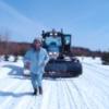
groomer Posted March 3, 2011 Author Report Share Posted March 3, 2011 Hi Groomer, talked to you on the phone from clubhouse Saturday afternoon. We found the "Radar" easy. Like you said, follow 587 toward Redemption. You know when you are close and there was a sign for lookout. What a view. It was also very sunny. Thanks hi snobeeler !! wooow !! awesome pics !!great day for you to go up there .never been there myself . glad you had a sunny day .thanks for taking a few mins to call me.very appreciated. mild temps here today ,now back to -10c , snowy and windy. grooming for the next 2 days.4 local trails tomorrow and tq 5 friday. thank you very much for sharing your pics !! all great pics ,but my favorite one ,the fourth one.tree on the left side looks like a totem.great shot !! groomer !!! Quote Link to comment Share on other sites More sharing options...
zeusand Posted March 3, 2011 Report Share Posted March 3, 2011 Hi Groomer, talked to you on the phone from clubhouse Saturday afternoon. We found the "Radar" easy. Like you said, follow 587 toward Redemption. You know when you are close and there was a sign for lookout. What a view. It was also very sunny. Thanks Incredible picture's Jay!!! Quote Link to comment Share on other sites More sharing options...
coldsmoke1 Posted March 3, 2011 Report Share Posted March 3, 2011 wow great pics thats now on my list of places to go Quote Link to comment Share on other sites More sharing options...
groomer Posted April 7, 2011 Author Report Share Posted April 7, 2011 http://www.youtube.com/watch?v=YkW92ruj6E0&sns=tw received an e mail earlier this morning about the radar.where trees are full of snow ,they call that ''zag '' zone d amplification de givre....'' amplification zone of frost'' not related to sledding ,but here s a video of mount logan in the gaspesie park.the cabin is about 2 miles east of mount logan,for cross country skiers. can see the towers at 2.07. groomer !!! Quote Link to comment Share on other sites More sharing options...
Snobeeler Posted April 8, 2011 Report Share Posted April 8, 2011 Yes, that is very cool. Would you estimate the tower is about 10 miles from where the video was shot? Quote Link to comment Share on other sites More sharing options...
groomer Posted April 8, 2011 Author Report Share Posted April 8, 2011 Yes, that is very cool. Would you estimate the tower is about 10 miles from where the video was shot? hi snobeeler !! i ve been about 15x on mount logan back in the 90's ,last time ,third week of april back in 00.i think i know enough the area there.video has been shot not too far from the cabin,going toward the towers.less than 3 miles from the towers. looks far, probably because the guy had a wide angle . rob is probably working on the site ,i ll post pics later. groomer !!! Quote Link to comment Share on other sites More sharing options...
groomer Posted April 13, 2011 Author Report Share Posted April 13, 2011 here s map around mount logan.when the sky is clear ,you can see the wind mill in cap chat. pic 1 :i was within 500' of the cabin. pic 2:view from the top.mount mattawee (first) ,collins and fortin pic 3:last steep hill before arriving to the towers,max 3/4 of a mile ahead.cabin is on the right.from the left,usually climb between sled 2 and 3 .once on top .don t forget to make a sharp left turn,very steep on the right. pic 4 :about 55 miles east from town,roughly 8 miles before arriving to the faribault camp.mount albert in the back. back in the 60's, maybe 70's too ,bombardier went there to test sleds. groomer !!! Quote Link to comment Share on other sites More sharing options...
Recommended Posts
Join the conversation
You can post now and register later. If you have an account, sign in now to post with your account.