Mid Range Posted January 30, 2012 Report Share Posted January 30, 2012 Even though Lepine Road wasn't in it's greatest shape,lots of white gold in Clova (3-4 feet).Stayed at the Tamarac.Thank you Al and Carole.Food was awesome.Home made meals with a personal touch,courtesy of our great cook Carole.See you soon.Since there was snow on the road we went all the way down to TQ 63 today.8-9 inches of powder on Lepine road but lots of big potatoes (rocks)underneath in the Lepine bridge area.Loggers are supoosed to start next week their logging operations.So it means take the woodrunner trail via Rabaska lodge if you guys want to go to Clova. Quote Link to comment Share on other sites More sharing options...
Sled Dog Posted January 30, 2012 Report Share Posted January 30, 2012 Thanks for info! Headin that way tomorrow! Quote Link to comment Share on other sites More sharing options...
iceman Posted January 30, 2012 Report Share Posted January 30, 2012 So lepine road will be no good once they start logging? I am confused? Woodrunner trail is 83 yes? 83 to lepine to rabaska?yes? More on the logging affects on the trail please? Looking to go to rabaska then up lepine and to 83 to clova in 2 weeks. Quote Link to comment Share on other sites More sharing options...
Mid Range Posted January 30, 2012 Author Report Share Posted January 30, 2012 Thanks for info! Headin that way tomorrow! have a safe trip.....been trying to reach you on your cell but no chance.Let me know when you are back in Maniwaki. Quote Link to comment Share on other sites More sharing options...
Mid Range Posted January 30, 2012 Author Report Share Posted January 30, 2012 So lepine road will be no good once they start logging? I am confused? Woodrunner trail is 83 yes? 83 to lepine to rabaska?yes? More on the logging affects on the trail please? Looking to go to rabaska then up lepine and to 83 to clova in 2 weeks. Ice...... I will show you a map tomorrow night. Quote Link to comment Share on other sites More sharing options...
Sled Dog Posted January 30, 2012 Report Share Posted January 30, 2012 iPhone is off! Too expensive to roam! Wifi is free though!! Quote Link to comment Share on other sites More sharing options...
iceman Posted January 30, 2012 Report Share Posted January 30, 2012 Yes thank you. I was there but did not get to ride to rabaska the other guys did and i'm needing to go back to ride it and go to rabaska and clova maybe mid feb. Quote Link to comment Share on other sites More sharing options...
rmk Posted January 30, 2012 Report Share Posted January 30, 2012 Yes thank you. I was there but did not get to ride to rabaska the other guys did and i'm needing to go back to ride it and go to rabaska and clova maybe mid feb. I will be at the rabaska 23 of feb to march 6th if your in the area look me up. Just ask Martin for the guy from Florida Quote Link to comment Share on other sites More sharing options...
Mid Range Posted January 31, 2012 Author Report Share Posted January 31, 2012 Iceman First map is Lepine road shown in green.Second map is Woodrunner trail shown in black. Woodrunner trail meets up with Lepine road at Km 54.Pensive (relay) is at Km57. From Km 54 to km 68 approx, they flatten up the snow bank on the shoulder for sledders. But most of us are staying on the road when there’s snow on it. North of km 68 is the groomed trail There is no trail south of km 54. We (locals) are jumping on it all the way down to TQ 63 which is crossing Lepine road at km 5 when it’s ridable and not sanded. It all depends of logging operations. here's a map of outaouais-laurentides. http://www.tourismeoutaouais.com/_upload/documentstrousse/2011-11-17cartemotoneige2.pdf Quote Link to comment Share on other sites More sharing options...
iceman Posted January 31, 2012 Report Share Posted January 31, 2012 Got it now midrange thanks very much for helping me get the picture in this area. Big thanks again. Quote Link to comment Share on other sites More sharing options...
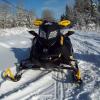
Mid Range Posted February 3, 2012 Author Report Share Posted February 3, 2012 Few pics Lepine road south of woodrunner trail Club Fontbrune near Rabaska Lodge The Iron Bridge over Gatineau River near Club Gatineau Break time The Pensive, located +- 45 miles from Club Fontbrune and +- 90 miles from Clova Hotel Tamarac in Clova Quote Link to comment Share on other sites More sharing options...
600IQHO Posted February 3, 2012 Report Share Posted February 3, 2012 Nice pictures! It is definately time to ride! The snow amounts look really good. Quote Link to comment Share on other sites More sharing options...
Recommended Posts
Join the conversation
You can post now and register later. If you have an account, sign in now to post with your account.