Andyman Posted January 25, 2016 Report Share Posted January 25, 2016 I was sitting here thinking how crappy this winter has been and I thought I should check Ontario out. Red is closed and yellow limited. Andy Quote Link to comment Share on other sites More sharing options...
Florida Snowman Posted January 25, 2016 Report Share Posted January 25, 2016 Pathetic! Aren't you glad you did that 18 day run last year Andy? Hope you're doing well. Tom Quote Link to comment Share on other sites More sharing options...
scorpionbowl Posted January 25, 2016 Report Share Posted January 25, 2016 Why doesn't Quebec have a map of conditions like that? Quote Link to comment Share on other sites More sharing options...
Andyman Posted January 25, 2016 Author Report Share Posted January 25, 2016 It sure would be nice to get this type of a map back for sure. Makes trip planning much simpler. Andy Quote Link to comment Share on other sites More sharing options...
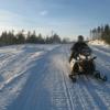
chris1v Posted January 25, 2016 Report Share Posted January 25, 2016 I went for a ride on Tuesday. I started in Arnprior and went to Pembroke for lunch. The trails were ok for the amount of snow we have. I'm sure they got beat up pretty bad though after this weekend. Quote Link to comment Share on other sites More sharing options...
snowfarmer Posted January 25, 2016 Report Share Posted January 25, 2016 Yup , I've been out twice this year in Ontario for a total of 300 miles. Last week we rode in the Barrie/ midland area that gets lake effect snow . It was not to bad considering what the groomers had to work with. Quote Link to comment Share on other sites More sharing options...
snowfarmer Posted January 25, 2016 Report Share Posted January 25, 2016 It is a great map and I wonder why they can't share technology. (Federations) This year according to the North Bay club site the trail in from the Quebec side into Ontario will be groomed by the club from Temiscaming . They have been doing this all along but now the trail will get a Quebec trail route number up to the Jocko river on the Ontario side . They have even got a new groomer to cover this expansion. Talk about working together! It is a great map and I wonder why they can't share technology. (Federations) This year according to the North Bay club site the trail in from the Quebec side into Ontario will be groomed by the club from Temiscaming . They have been doing this all along but now the trail will get a Quebec trail route number up to the Jocko river on the Ontario side . They have even got a new groomer to cover this expansion. Talk about working together! Quote Link to comment Share on other sites More sharing options...
Cnc Posted January 25, 2016 Report Share Posted January 25, 2016 Closest Quebec has to that Ont map is an interactive map on the fcmq web site for route planning and " I Motoneige " the trail map app you down load to your phone. Neither show what routes are open, although "I Motoneige" does have little groomer icons that show when any given section was last groomed. Quote Link to comment Share on other sites More sharing options...
PLAYHARD Posted January 27, 2016 Report Share Posted January 27, 2016 Why doesn't Quebec have a map of conditions like that? Really really? Click "Services" in the top right corner, then click "Delai de surfacage", then check the color-key in the bottom left corner for the hours since the last groomer pass, or click on any trail for the detail... http://fcmq.viaexplora.com/carte-motoneige/index.html Quote Link to comment Share on other sites More sharing options...
Recommended Posts
Join the conversation
You can post now and register later. If you have an account, sign in now to post with your account.