themainer Posted February 24, 2016 Report Share Posted February 24, 2016 First post here though ive been browsing the last week or so. Our original plan to ride to Matane from Maine got ruined by this rain so we've shifted our focus to a trip up to Lac St Jean. I've never been so I don't know anything about the area other than what we've been told by others in our riding group and what I've researched. Planning on staying at the Roquemont in St Raymond (pending snow conditions) Tuesday night next week after the ride up and leaving the truck there til Saturday while we saddlebag. First day we plan to ride from St. Raymond up 73 to Relais 22, then up to St. Felician for the night. 2nd day we're going to ride around the north side of the lake then over to the Mt. Valin area to check out the mountains then I was thinking of staying at the Tourelle Du Fjord. Third day we'd do the loop down to Taddousac, take the ferry, then come back up 383 to the Delta and stay (we already have a reservation for this night since it's friday) then the last day will be from the Delta down 23 back to St. Raymond. The 2nd day is the most up in the air on desired route. Any must see sights, must ride trails, best restaurants, etc or any other lodging recommendations? We usually have no problem averaging over 250 a day south of the river, I imagine riding is better around this area. Quote Link to comment Share on other sites More sharing options...
Grampsledder Posted February 24, 2016 Report Share Posted February 24, 2016 We just stayed at the hotel Jardin in St Felician. It was very nice, excellent food. Bar was not open mid week but the waitress opened it for us. 93 north and west around the lake is a great ride. Quote Link to comment Share on other sites More sharing options...
im4snow Posted February 24, 2016 Report Share Posted February 24, 2016 Ambitious days. When leaving St Felician......I outlined in red (see below, excuse the poor artwork) the route I've been on and I really enjoyed it. However, it will add to your mileage that day as there are shorter ways around the lake. Quote Link to comment Share on other sites More sharing options...
SkippyDoo Posted February 25, 2016 Report Share Posted February 25, 2016 Looks good to me if you want to put on miles. To keep in mind the 93 gets hammered esp between LaChappele KM31 and the ski slope. East of that usually stays ok. Orange trails when you can are usually better on Valin. Valin west trails tend to be in better shape than Valin east. The 23 down to Mont Apica can get bet up too. The Mont Apica overlook right before the relais is worth going up if the weather is good. There are some nice overlooks on 83 around LaBaie. There are the 5 summits in Valin. They are marked well and shown on the map. You can do all 5 in one day if you wanted. The whole area is a must see really. Quote Link to comment Share on other sites More sharing options...
themainer Posted February 25, 2016 Author Report Share Posted February 25, 2016 (edited) Thanks for the advice so far guys, much appreciated. I think we'll stay at the Jardin in St Felician as we were already looking at that one along with the Borealie. Where is La Chapelle? Can't seem to find it on the map or google, although I did find the ski resort you were talking about. This is what I was thinking for our day 2 approximately. We run 800 etecs so I don't like going much more than 100 miles between fuel stops although we will have one sled with an extra 2.5 gallons: Any alterations or suggestions you'd make on this route? Any good lunch stops around Lac Sebastian? Edited February 25, 2016 by themainer Quote Link to comment Share on other sites More sharing options...
im4snow Posted February 25, 2016 Report Share Posted February 25, 2016 Ok, since you didn't like my first advice I'm out. Did you mileage map day two....it seems pretty ambitious...but doable? Quote Link to comment Share on other sites More sharing options...
themainer Posted February 25, 2016 Author Report Share Posted February 25, 2016 (edited) Ok, since you didn't like my first advice I'm out. Did you mileage map day two....it seems pretty ambitious...but doable? Haha, yeah, from talking to one of our buds who is up there alot he said we should try to do alot of the orange around valin if we could, only way we can fit it in is if we skip the big 93 loop. We'll save that for next time.The route mapped out is 273 miles with stops every 100 miles or less for gas. We may add more or less depending on how well we are making time and the conditions of the trails. Edited February 25, 2016 by themainer Quote Link to comment Share on other sites More sharing options...
im4snow Posted February 25, 2016 Report Share Posted February 25, 2016 Haha, yeah, from talking to one of our buds who is up there alot he said we should try to do alot of the orange around valin if we could, only way we can fit it in is if we skip the big 93 loop. We'll save that for next time. The route mapped out is 273 miles with stops every 100 miles or less for gas. We may add more or less depending on how well we are making time and the conditions of the trails. I agree on the orange trails around Valin. Hard to go wrong in that entire region in my experience. How many sleds on the trip? Quote Link to comment Share on other sites More sharing options...
themainer Posted February 25, 2016 Author Report Share Posted February 25, 2016 I agree on the orange trails around Valin. Hard to go wrong in that entire region in my experience. How many sleds on the trip? Well, it was originally 5, one who knows the area like the back of his hand, now it's down to just dad and I. We can make really good time on our own and have a good time. Quote Link to comment Share on other sites More sharing options...
SkippyDoo Posted February 25, 2016 Report Share Posted February 25, 2016 LaChapelle is real close to KM31. If your going 93 east you will arrive at KM31 first then LaChapelle is the next one. I would say roughly 10 miles you can crooss the lake as well. They prefer cash for gas. But KM31 took CC for fuel as we where getting lunch also. There is a gas station trail side on 93 in ST Honor. Cheaper alternative and buy less gas on Valin that way. We tried to do all 5 summits and the frozen waterfall, glacier when we where up there last week. With real good trails it can be done if you hustle. Sight seeing can be time consuming on big mile days. We got tired of bumpity bump so skipped 2 of them, took the orange trails between lachappele and passion. Plus the frozen waterfall is a bit of an off trail excursion that will easily chew up an hour. Just to give you an idea, they call the area between Mont Vilian in Lamarche over to KM31 on Valin and down to Mt Apica the bermuda triangle. It can get rough. But with spring breaks over with in US and Canada maybe it will be better. Traffic was high even weekday. Delta was jammed. If you can catch those trails when its good, its great riding. The best ride for us was the L'Anse St Jean loop 383 83 301 back 383 83 to Delta. Quote Link to comment Share on other sites More sharing options...
dooright Posted February 25, 2016 Report Share Posted February 25, 2016 (edited) The new bridge was almost completely in when we went by this past Saturday, thinking the reroute outside of st Felician isn't in play any longer. Edited February 25, 2016 by dooright Quote Link to comment Share on other sites More sharing options...
Grampsledder Posted February 25, 2016 Report Share Posted February 25, 2016 Headed back up next weekend. Where is the frozen waterfall in Mont Valin? Might check that out. We did the 267 trail south (Bras Louis) last week and the views were nice. We stay at KM 31 in the heart of Valin. It's right on 93 if you want to head to Tadoussac and the ferry. That might save you a few miles. Quote Link to comment Share on other sites More sharing options...
SkippyDoo Posted February 25, 2016 Report Share Posted February 25, 2016 The water fall is on LacDes Canots. I think its the 252 orange trail. If your going 93 east to the last local trail that heads north to the Pelchat trail, there will be a small sign for glacier. Its a goat trail that takes you down to the lake. Then go north on the lake, its on the left, cant miss it. Should be tracks leading right to it unless recent snow covered them up. Quote Link to comment Share on other sites More sharing options...
Grampsledder Posted February 25, 2016 Report Share Posted February 25, 2016 Thanks. We'll look for it. Quote Link to comment Share on other sites More sharing options...
markusvt Posted February 25, 2016 Report Share Posted February 25, 2016 I like the cave and the waterfall myself. The new look-outs are so weak compared to the old real la-hutte. Quote Link to comment Share on other sites More sharing options...
themainer Posted February 25, 2016 Author Report Share Posted February 25, 2016 I like the cave and the waterfall myself. The new look-outs are so weak compared to the old real la-hutte. Interesting. So the cave is south of Lac La Mothe near the dam from what I can tell? And the waterfall is near/on which lake? We don't have GPS's and the local trails online aren't marked with what number they are. Quote Link to comment Share on other sites More sharing options...
SkippyDoo Posted February 26, 2016 Report Share Posted February 26, 2016 The waterfall is off the easternmost orange trail on valin. It runs north south from 93 to the pelchat trail to Escoumins. The goat trail to lake is on the east side of 252 just north of the 93 intersection. You will know it's the right intersection cause it's at a point where there is a sharp turn on 93. Quote Link to comment Share on other sites More sharing options...
themainer Posted February 26, 2016 Author Report Share Posted February 26, 2016 The waterfall is off the easternmost orange trail on valin. It runs north south from 93 to the pelchat trail to Escoumins. The goat trail to lake is on the east side of 252 just north of the 93 intersection. You will know it's the right intersection cause it's at a point where there is a sharp turn on 93. Ah, ok, now I know what trail you're talking about. So once I turn off 93 to head north up that trail will it be on the right or left? How far off the groomed trail will it be? Thanks for the info on this, Im hoping the cave will be easier to find. Quote Link to comment Share on other sites More sharing options...
SkippyDoo Posted February 26, 2016 Report Share Posted February 26, 2016 It will be on the right. It's a few miles north of the intersection. The goat trail is a mile or so. Should be a sign that says glacier with arrow on 252 Quote Link to comment Share on other sites More sharing options...
PLAYHARD Posted February 27, 2016 Report Share Posted February 27, 2016 The notorious Iceman high-marking the falls (on Scorpion Bowl's birthday!)... Quote Link to comment Share on other sites More sharing options...
Trailblazer Posted February 27, 2016 Report Share Posted February 27, 2016 I got a beautiful shot of us in front of that back in the '90's. Quote Link to comment Share on other sites More sharing options...
zeusand Posted February 28, 2016 Report Share Posted February 28, 2016 very cool picture Quote Link to comment Share on other sites More sharing options...
Grampsledder Posted March 4, 2016 Report Share Posted March 4, 2016 I've never been so I don't know anything about the area other than what we've been told by others in our riding group and what I've researched. How was your trip? Quote Link to comment Share on other sites More sharing options...
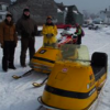
themainer Posted March 7, 2016 Author Report Share Posted March 7, 2016 Finally got the pictures off my phone. Did 935 miles in 4 days, left from St. Raymond on Wednesday in the blizzard and returned saturday under a beautiful blue sky day. Definitely gave me a better appreciation for what riding in Quebec is. Around Valin and the Fjord is much different than southern Quebec and Maine in respect to making time. Due to us pushing it back a week due to the storm last week we lost the other 3 guys in our group so it was another classic father/son trip. I appreciate all the advice and info I was able to get on this site. Made the trip alot easier knowing what to expect. Day 1 is Red, 2 is Green, 3 is Yellow, and 4 is Purple Day 1: The blizzard Left St. Raymond at 7:30am with a foot of fresh on the ground and a blizzard warning in effect. By leaving 30 mins later than planned we were able to follow a set of tracks from the hotel all the way to trail 355 just before La Tuque and there we met 2 sleds coming the other way which gave us more tracks to follow. This helped greatly in making time. As we got closer to Relais 22 the snow was lightening up but with the same amount on the ground. On a 90 degree turn I just happened to look over my shoulder to the left to see if Dad was still behind me and noticed a 1200 buried on the side of the trail which I would have never seen if I didn’t look that way. Helped him out of 5 feet of snow and he was very appreciative. Arrived at Relais 22 at 3:30, ate, fueled, and left by 4:10 for the last 80 mile push to Roberval. Trail was ok cruising for the first 50 miles as we were thinking the guys telling the horror stories about the trail at Relais 22 had obviously never ridden the Greenville RR bed on a Saturday afternoon. The last 30 miles into Roberval featured honest 3 foot deep moguls in some hills and corners and we realized maybe he wasn’t exaggerating. Helped 2 more sleds get unstuck and saw the ATV groomer buried on a corner as well. Fields in Roberval were horribly drifted, but we made it to the hotel at 8:00pm, 288 miles: Stopped to clear a downed tree: Relais 22: Quote Link to comment Share on other sites More sharing options...
themainer Posted March 7, 2016 Author Report Share Posted March 7, 2016 Day 2: Cold Warning: Started off at 9:30am as there was an “extreme cold warning” in effect due to the high winds and -12F temps. Even with my new wizbang grandpa windshield the cross wind was still nasty. In the woods was great, but the route around the lake had many, many fields which all seemed to be drifted even with a fresh grooming the night before. Ate in St. Honore at 2pm and then went up the “The Cave” which now I realize must be an old tunnel they drilled to let the water go around the Dam on Lac Le Mothe when they were building it. Still very cool sight. Made it back into the hotel near Saint Rose at 6pm after only 210 miles which seemed like plenty that day: Nice windbreak: The Cave: A little farther in: The lights of Saguenay: Quote Link to comment Share on other sites More sharing options...
Recommended Posts
Join the conversation
You can post now and register later. If you have an account, sign in now to post with your account.